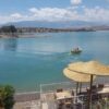
The highest peaks of the High Atlas lie within the Jebel Toubkal (4167m) region, North Africa’s highest mountain. Roughly bounded by the Tizi n’Test to the west and the Tizi n’Tichka to the east, this area is by far the most popular trekking destination in Morocco.
The High Atlas range is characterised by jagged peaks and steep-sided valleys, with flat-topped Berber villages and cultivated
green stepped terraces scattered throughout. The traditional culture of the Berbers re- mains little changed after centuries.
There are village gîtes and refuge huts es- tablished in this region and more than 60 official mountain guides who know the area extremely well. A large network of well maintained mule trails wend their way over high passes and dramatic valleys, linking village to village.

Il y a des promenades ici pour tous les niveaux - vous pouvez partir avec des mulets, des porteurs et des cuisiniers pendant des semaines ou vous baser dans l'un des plus grands villages et explorer à partir de là.
Trekking dans le Haut Atlas
To maintain the goodwill that is so openly given, it is worth bearing in the mind that the mountain economy is one of basic subsistence farming.
In outlying villages there may be little in the way of surplus food – be generous when buying provisions for yourself, guides and so on.
Always obtain permission to camp if anywhere near a village. Dress modestly (see the Society & Conduct section in the Facts About the Country chapter) – this is extremely important; it may not be obvious, but locals can be terribly offended by what they perceive to be a lack of respect. When staying in village accommodation
be prepared to pay the same rates as in refuges and basic hotels. Take some time to learn a few basic Berber words. Above all, don’t be in a hurry to do anything. It is possible to trek in the Toubkal region year round, but the best time to visit is prob- ably late spring, between April and May. The bulk of the snow will have melted (Jebel Toubkal itself is usually under snow from November until mid-June), spring flowers will be in bloom and the days will be pleasantly warm.
You’ll still need a good sleeping bag and warm clothes as the nights will be chilly. In mid-summer, temperatures in the higher areas never become stifling, but it can be unbearably hot in the lower valleys.

À l'automne, les températures sont nettement plus fraîches et la neige tombe sur les sommets les plus élevés à la fin du mois de septembre.
Late winter can be an excellent time to visit, if you don’t mind night time temper- atures dropping to well below freezing (-20°C on a bad night). The days are sur- prisingly warm, the skies generally clear and the valleys extremely quiet and peace- ful at this time of year.
Jebel Toubkal is an easy two day trek and provided there’s no snow around you don’t need mountaineering skills to get to the top.
Les conditions hivernales, cependant, peuvent être perfides (il y a eu plusieurs décès sur la montagne) et, à ce moment-là, il est conseillé aux grimpeurs inexpérimentés de marcher sous la ligne de neige.
Anyone attempting the ascent after snow has fallen should have some winter climb- ing experience. You won’t get to the summit unless you have full alpine gear – and that means ice axes, crampons, wet weather clothing and a very warm sleeping bag.
Le mal d'altitude, causé par le manque d'oxygène, est une possibilité à des altitudes supérieures à 3000 m. Les symptômes peuvent inclure des maux de tête, des nausées, des étourdissements, une toux sèche et de l'insomnie. Les symptômes s'atténuent généralement au fur et à mesure que vous vous acclimatez, mais s'ils persistent ou s'aggravent, vous devez descendre immédiatement (voir la section Santé du chapitre Faits pour le visiteur pour plus d'informations).
Le point de départ habituel du Jebel Toubkal et de nombreux autres treks de la région est le village d'Imlil dans la vallée de Mizane, à 17 km au sud d'Asni.
D'autres points de départ possibles sont les villages de Setti Fatma et Oukaïmeden dans la vallée de l'Ourika.

Information
Guides You don’t need a guide if you just want to whiz up Toubkal and back, but if you’re going further afield or for a longer